Lillaz Waterfalls

Edited by:
Massimo Martini
Access
Road directions
At the Aosta Ovest junction on the motorway, turn right and join the towards Cogne. Drive through the village of Aymavilles and, at the roundabout, take the second exit, staying on the (1.5 km). Continue past the hamlets of Vieyes, Épinel and Crétaz for 19.8 km (21.3 km) until you reach the roundabout near Cogne; take the first exit, staying on the , and continue for 2.8 km (24.1 km in total) to the Lillaz car park.
Car park
The Lillaz car park 🅿️, at the entrance to the village, is divided into three sections: the spaces closest to the start of the footpaths are subject to a charge, the central ones are free, and those furthest away are reserved for campervans. From the car park, cross the bridge over the Urtier stream to enter the village, where the footpaths to the waterfalls begin.
Access by public transport
Cogne is connected to Aosta by the SVAP 340 “Aosta–Cogne” route, which operates all year round, departing from Aosta coach station. During the summer, Lillaz can be reached from the Cogne Revettaz stop via the SVAP urban shuttle bus, line 193 “Cogne Urbana Estiva”, which stops at Lillaz Piazzale. For up-to-date timetables, please visit the SVAP Routes and Timetables page.
Access on foot
from Lillaz, via trails and | Lillaz Waterfalls, loop from the Lillaz car park
from Lillaz, via trail | Lake Loie via the Vallon de l'Urtier, from the Lillaz car park
Distance and walking time
🕒 Walking time: 33 minutes
📏 Distance: 24.1 km
GPS navigation
Important information
The directions provided were verified on the date the route was mapped. Before setting off, we recommend checking for any changes to the route or road conditions. For up-to-date information, please consult Google Maps or Apple Maps.
Introduction
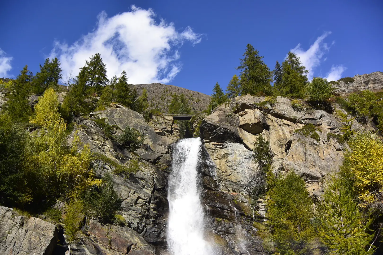
The Lillaz Waterfalls are formed by the Urtier stream just upstream of Lillaz, a hamlet of Cogne, in the Cogne Valley and within the Gran Paradiso National Park. As it flows down from the Vallon de l’Urtier towards the valley floor, the stream cascades over a series of rocky steps with three main drops, reaching a total height of around 150 metres. The lower cascade can be reached in a few minutes from the village, along an initial accessible section of the route; the two upper cascades can be viewed from the path that climbs the slope via steps and footbridges and returns to Lillaz in a loop. The plateau above the falls is a junction for routes leading to the Vallon de l’Urtier and the Vallone di Bardoney. In winter, the falls freeze over and are a popular spot for ice climbing.
Description
The lower waterfall ends in a natural pool at the foot of the cliff, just a few minutes’ walk from the houses in Lillaz. The first section of the route, which runs from the square at the entrance to the geological park alongside the stream to the base of this waterfall, features information panels on the geology and glacial history of the valley. The middle waterfall can be viewed from a viewpoint on the path that climbs the slope via wooden steps, sections carved into the rock and footbridges with wooden railings. The upper waterfall, the highest of the three, cascades into a rocky amphitheatre which can be reached via a wooden bridge, near the grassy clearing where the walking trail ends.
The hillside is covered by a larch forest (Larix decidua) and Norway spruce (Picea abies). Above the waterfalls, the path climbing towards the Vallon de l’Urtier crosses the penstocks of the CVA hydroelectric power station at Lillaz and passes by a wayside shrine.
In winter, the falls form ice flows that are climbed: the main route, on the Lillaz waterfall, is graded I/3 over a vertical rise of approximately 220 metres, and other routes can be found on the walls in the area.
Information
General information
Altitude: 1,717 m
Total height: approx. 150 m
Number of drops: 3
Watercourse:: Urtier stream
Town: Cogne
Hamlet: Lillaz
Protected area: Gran Paradiso National Park
Region: Aosta Valley
Country: Italy